Links
This project is a location tracking server that receives data from the Overland GPS tracker app running on my phone. This app tracks my location, but instead of sending it to Google or any other big corporation, it sends it to my private server running Roverland.
As I’m writing this, I have been tracking my location for seven months. My whole location history only takes up 43Mb once compressed.
Thanks to this project, I can go back in time and figure out exactly where I was anytime (as long as I had my phone with the app turned on) while preserving my privacy. I might also find this location archive useful in the future.
Features
- Multiple user accounts.
- Web interface.
- Location, Altitude, Battery level and state, Movement type, and current wifi name tracking.
Planned:
- Location-based search
- Path optimization
- Better UI
- Store user preferences and allow setting colors, theme, etc.
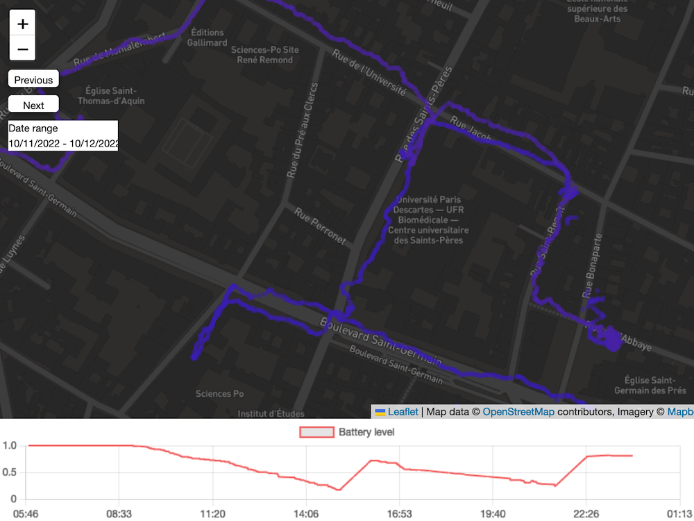
A quick description of the app
The general principle is described in the figure below:
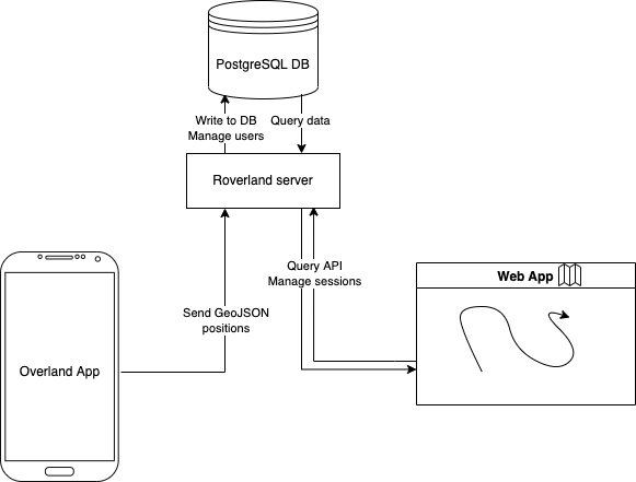
The app architecture
Interface
Here is an example of what the interface looks like. It is quite rudimentary now, but improving it is part of my future plans. For now it is enough to explore past locations day by day or on a range of dates.